| |||
|
Oxford to Poole (9 to 16 June 2006) Poole to Exmouth (16 to 22 June 2006) South Devon (22 to 27 June 2006)
|
Cornwall, 27 June to 7 July 2006 | ||
| From Plymouth I took the ferry to Cremyll. I walked through
the woods of Mount Edgcumbe to Cawsand
- yet another seaside haunt of my childhood. Next day saw
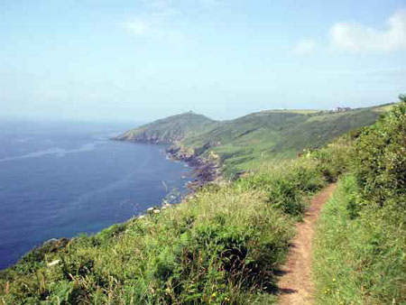
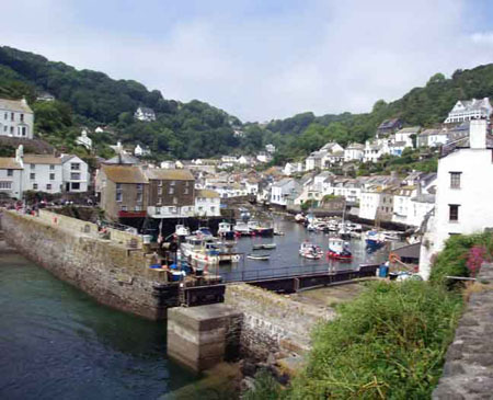
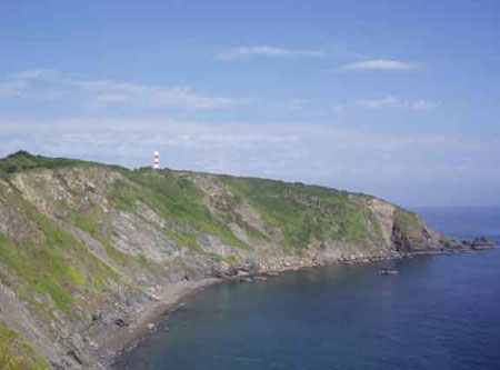
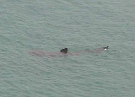
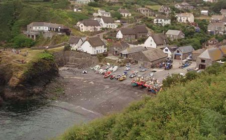
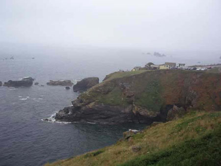
more fine walking around Rame Head, Day 20, from Looe to Polperro and on to Polruan, was, so the guidebook said, the toughest stretch on the South Cornwall coast path. Some steep climbs, but nothing compared with north Cornwall or even east Dorset. The scenery was spectacular, and as a bonus there were basking sharks to watch from the cliffs above Polruan. I took the ferry across to Fowey, and headed out to Gribbin Head with its curious striped daymark (like a lighthouse without the light). Then past the tiny village of Polkerris to the B&B at Par. Next morning was easy going past the china clay works and the suburbs of St Austell. After Porthpean the route reverted to the classic ups and downs of coast path walking. Eventually I reached Mevagissey - a place with even more traffic problems than most Cornish fishing villages. Then round Chapel Point, with a magnificently sited house on its tip, to Gorran Haven. The next stretch was one of the finest, and at Dodman Point the coast opened up to the Lizard. At the Dodman I was disconcerted to find that the youth hostel at Boswinger, whose answering machine had confidently predicted plenty of beds, had just sold its last bed. Fortunately the B&B next door had a room. Whenever I walk past a youth hostel with a full car park and no room for a walker I remember the days when cars were verboten at youth hostels - but I suppose the YHA like everyone else has to make ends meet. More
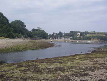
logistical problems next day. There is nowhere to stay between Portscatho and
the ferry to St Mawes, and the last ferry leaves at 5.15 pm. Portscatho seemed
too short a day, so I decided to aim for the ferry, confident that I would have
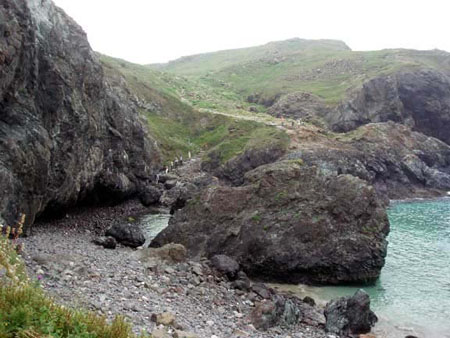
no problem finding accommodation in a town as big as Falmouth. The path past Portloe The coast path round the Lizard peninsula is deservedly popular, and I had many more walkers for company for the rest of the trip. First, there was more water to negotiate. I took the ferry across the Helford River, and then, a few miles further, waded across Gillan Creek. South of Porthallow the path diverts inland to avoid some coastal quarries, then it was easy going to Coverack and its well-sited youth hostel. I had seen basking sharks every day since Polruan, but the best sightings came next day. Basking sharks are enormous - 30 feet or more, the second largest fish in the world. Near Kennack Sands a group was close inshore where the water was clear. I sat for ages watching them from the clifftop. At Cadgwith - a picture postcard village - I met one of the few Cornishmen left on the coast. He told me that most of the village houses were second homes, a few occupied full-time by incomers. From Cadgwith the path led past a series of spectacular coves and headlands to Lizard Point. There, people were waiting their turn to be the southernmost person in England. Then I headed half a mile north to my B&B in Lizard Town. I headed north from Lizard Point next day on one of the most scenic stretches of the whole coast path. At Kynance Cove the path squeezes between the sea and the bottom of the cliff, and at Mullion Cove the basking sharks were out in force. Then, past Gunwalloe, I left the granite cliffs of the Lizard and traversed gentler slopes to the gravel beach of Loe Bar and Porthleven. More grand scenery next day - tiny coves
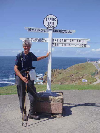
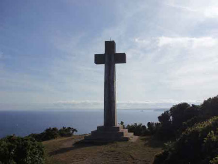
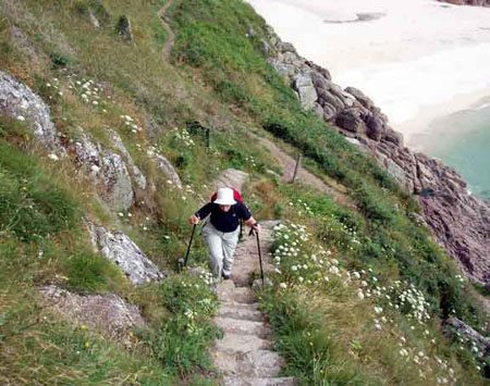
and rugged headlands. After Prussia Cove Penzance to Land's End is a comfortable one-day walk, but I decided to make it an easy 2-day stroll. I had a good look round Mousehole, had a leisurely lunch in the cafe at Lamorna Cove, then tackled the very rocky stretch to Tater-du and on to Porthcurno for the night. Susan had driven down to join me for the last day's walking. Next morning we both scaled the steep steps beside the Minack Theatre. At Gwennap Head the buildings of Land's End came into sight. Then the spectacular end to the walk, past Nanjizal Cove to Land's End itself. It is customary for walkers to be sniffy
about Land's End. I reached Land's End 28 days after leaving Oxford, on 7 July, which was my 60th birthday.
| |||
 then
up and down among the holiday cottages above Whitsand Bay and through the Tregantle
Firing Range to Portwrinkle. Downderry, Seaton and Looe followed - more familiar
places of my youth. Susan had come down to replenish supplies, and we met at the
guest house above the harbour.
then
up and down among the holiday cottages above Whitsand Bay and through the Tregantle
Firing Range to Portwrinkle. Downderry, Seaton and Looe followed - more familiar
places of my youth. Susan had come down to replenish supplies, and we met at the
guest house above the harbour.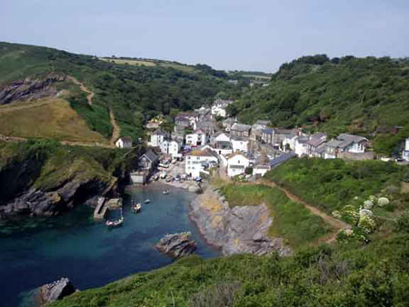 was tough in parts, but mostly easy going, and I reached Place in good time to
catch the ferry to St Mawes and the connecting ferry to Falmouth. Then another
problem: I rang a dozen places and knocked on another dozen doors, but the whole
town was full. Everything from the backpackers' hostel to the 4 star hotel was
booked solid. My last chance was a B&B at Mawnan Smith, 5 miles south of Falmouth.
Yes they had a room - but they were just going out for the evening to a wedding
party and would not be back till late. Something in my voice must have betrayed
my desperation, and they suggested that I went to the party at the Red Lion and
picked up the key. So I pitched up at the pub at 9 PM, drank a toast to the happy
couple, and headed gratefully to bed.
was tough in parts, but mostly easy going, and I reached Place in good time to
catch the ferry to St Mawes and the connecting ferry to Falmouth. Then another
problem: I rang a dozen places and knocked on another dozen doors, but the whole
town was full. Everything from the backpackers' hostel to the 4 star hotel was
booked solid. My last chance was a B&B at Mawnan Smith, 5 miles south of Falmouth.
Yes they had a room - but they were just going out for the evening to a wedding
party and would not be back till late. Something in my voice must have betrayed
my desperation, and they suggested that I went to the party at the Red Lion and
picked up the key. So I pitched up at the pub at 9 PM, drank a toast to the happy
couple, and headed gratefully to bed.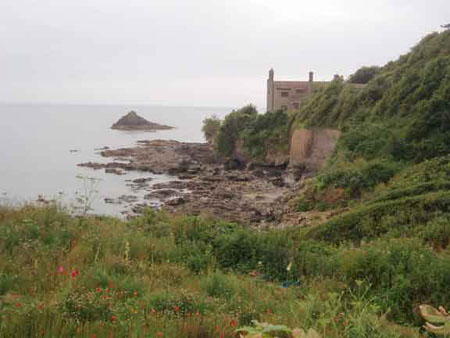
 OK, there are tacky exhibitions and gift shops. But it is a magical place, with
dramatic seascapes, views out to the Scilly Isles. Popular places are usually
popular for good reason, and Land's End makes a fitting end to England.
OK, there are tacky exhibitions and gift shops. But it is a magical place, with
dramatic seascapes, views out to the Scilly Isles. Popular places are usually
popular for good reason, and Land's End makes a fitting end to England.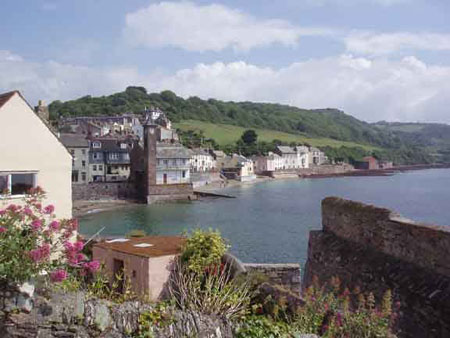